Jebel Shams in Oman is unofficially tagged as the Grand Canyon of the Middle East and no one wants to disagree. If you want to hike up to the summit, this guide is for you. Here's everything you need to know about the summit trail of Jebel Shams!
Disclaimer: We did the hike back in December 2017 and there might be some changes on the trail, the mountain itself, and regulations (if applicable).
Hiking Overview:
- Route: Jebel Shams W4 Trail or Summit Trail
- Distance: own record cannot be found (will update this next time)
- Highest Elevation reached: South Summit at 2,997 MASL (North Summit is a restricted area)
- Day(s) needed: 2 (recommended)
- Difficulty Level (own opinion): 2.5 out of 5
- Ideal time to hike this trail: All year round however it can get chilly and cold in the mountain during winter
How to get there and how to get out?
Similar to the UAE, the jump-off and the canyon itself are not accessible by public transportation based on our experience back in 2017. Hence I will not include an option of public transportation anymore.
However, you will find the coordinates of the parking location and the trailhead below for your reference.
The Summit Trail (W4 Trail) is a backtrack trail which means you start and finish at the same coordinates. From the pin location above, you can go back to Dubai right away or you can roam around Nizwa to maximize your Oman trip before heading back to Dubai.
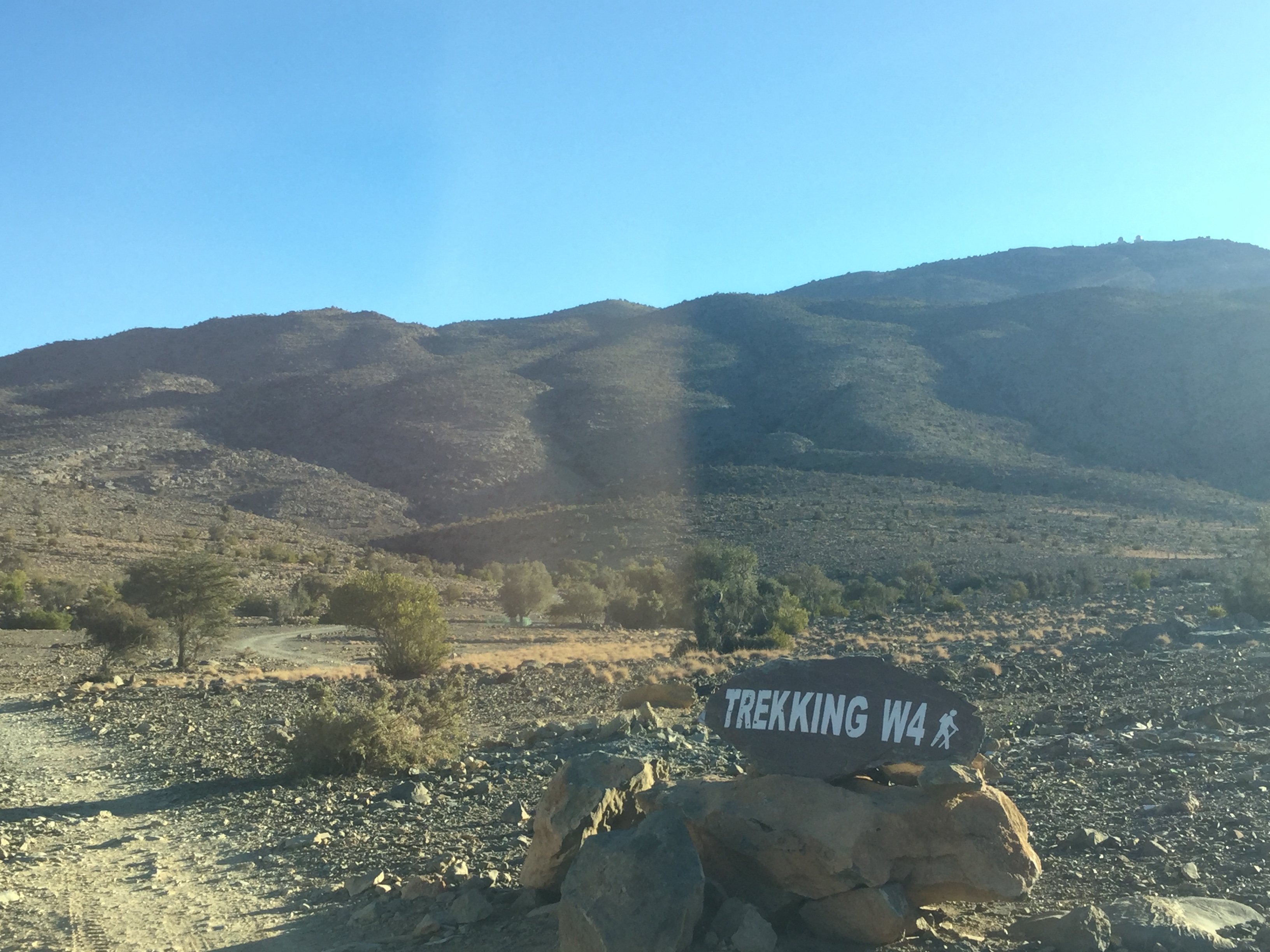
Hiking Trailhead:
The pin location shared above will bring you to this signpost which is your official trailhead of the trail.
However, from here, you can drive further inside until you reach a narrow gorge with some trees where you can park your car. While a sedan can push through, we recommend taking a 4x4 as you will pass by a lot of off-road tracks.
Two (Main) Hiking Trails of Jebel Shams in Oman:
There are two main trails in Jebel Shams. Of course, there are other sub-trails around the canyon but I will not discuss that further. In case you're not sure which trail to take, check your options below:
- W6 and W6a or Balcony Walk – Easy trails along the rim of the canyon walls towards the old abandoned village. These two trails offer stunning views of the canyon at a lower elevation. If you don’t want to go to the summit but fancy an amazing canyon view, this trail is for you.
- W4 or Summit Trail – Unfortunately, the North Summit (3,009 MASL) is a restricted area. Longer in distance, this trail takes you to the South Summit (2,997 MASL) and you will also get an amazing view of the canyon from the South Summit side.
This hiking guide is about the backtrack trail of the W4 Trail towards the South Summit of Jebel Shams. While it is doable to do a day hike, we found it a long hike for a day hike. I highly recommend doing it in 2 days (overnight camp) for you to be able to enjoy both the hike and the magnificent views.
Hiking Trail Sections of the Summit Trail of Jebel Shams:
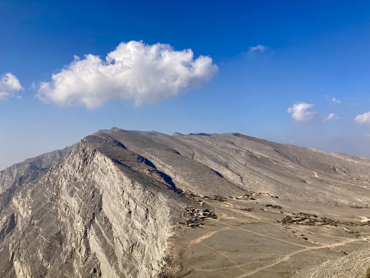
1. Foothills & Rim of the Canyon
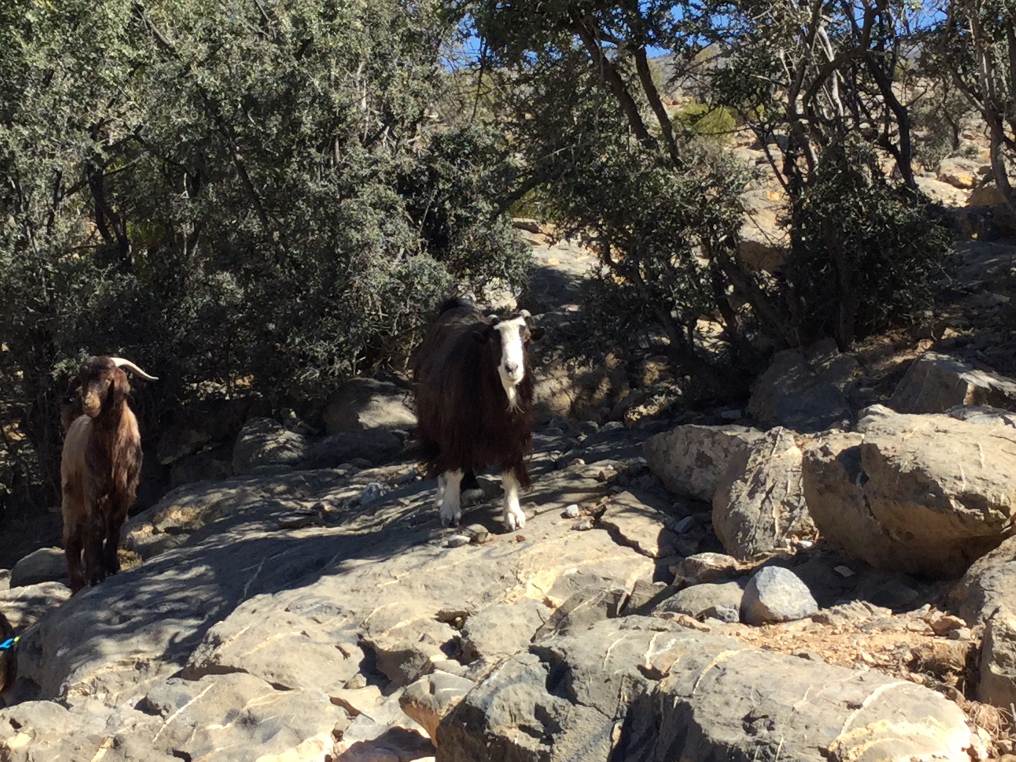
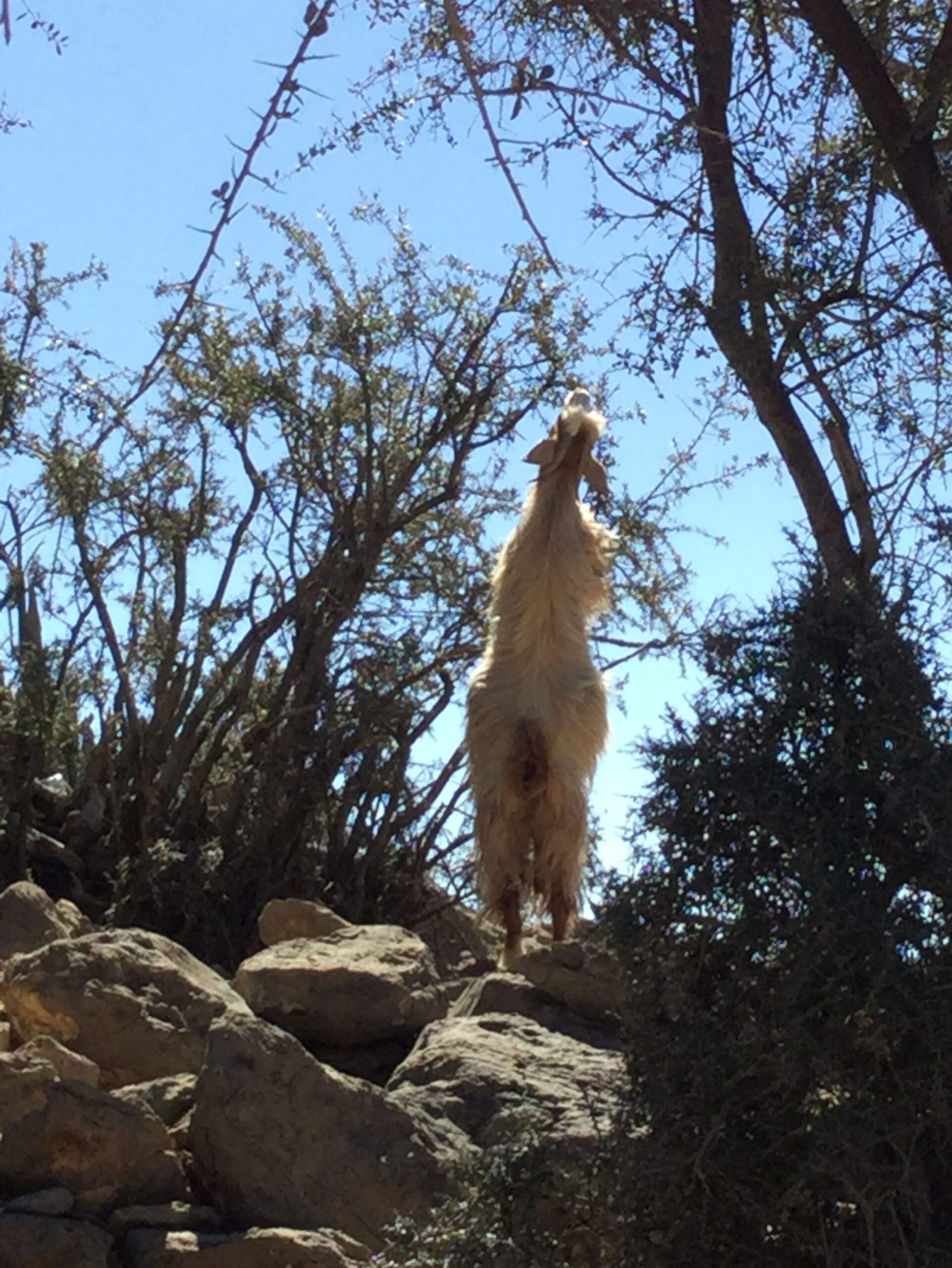
As mentioned above, you can drive further inside from the trailhead and secure your parking at the base camp. The base camp has lots of goats during our visit, but no facility (toilet, water resources, grocery) at all.
From the base camp, the trail starts on a gentle slope of the foothills crossing a few wadis (dry riverbeds) from time to time.


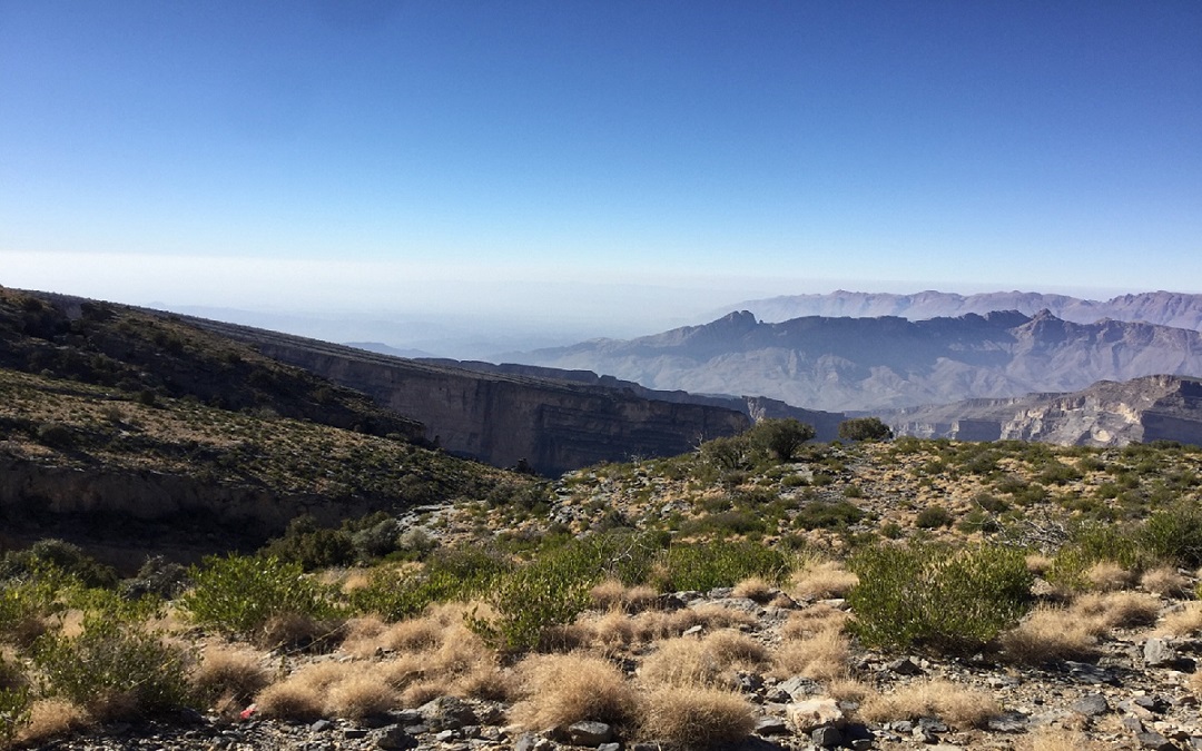
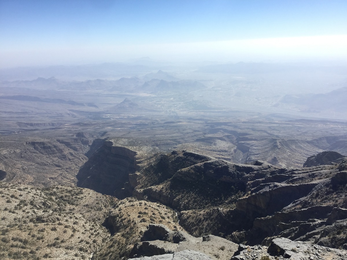
After crossing the wadis, you will start hiking your way up until you reach the rim of the canyon. Beware of the sheer drop on the edges and make sure to guarantee your safety before posing for your photos.
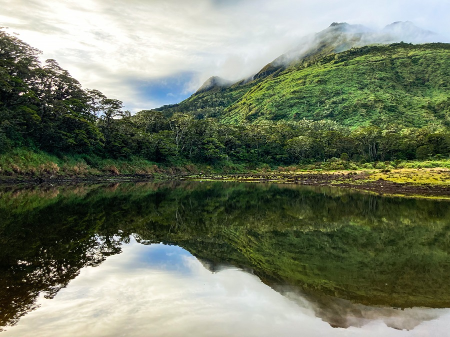
While I am not sure if this view is as amazing as the Balcony Walk view, it's still an incredible view and unlike any other canyon I've seen. Well, to be fair, I've only seen the Charyn Canyon in Kazakhstan and Skazka Canyon in Kyrgyzstan, and boy all of them (including this) are beautiful in their own way.


Going back to the topic, from this point onwards, enjoy the ruggedness of the landscape. As expected of its arid environment (like the UAE), there was little to no vegetation at all except for the varying hardy shrubs and juniper trees.
On the bright side, the trail signs were marked very well although the intervals were not consistent. The trail signs were painted in a yellow-white-red pattern and they are visible up to the summit.
2. Campsite, North Summit & Valleys
There are different plateaus as camp options spread out along the trail. Make sure to choose wisely and not at the edge as there are occasionally strong winds, especially at night.
As you hike higher, you will come close to the North Summit (true summit) of Jebel Shams but beware as this is a restricted area by the military. It is 100% off-limits to civilians so I DO NOT suggest going in that direction unless it is an emergency (between life and death).
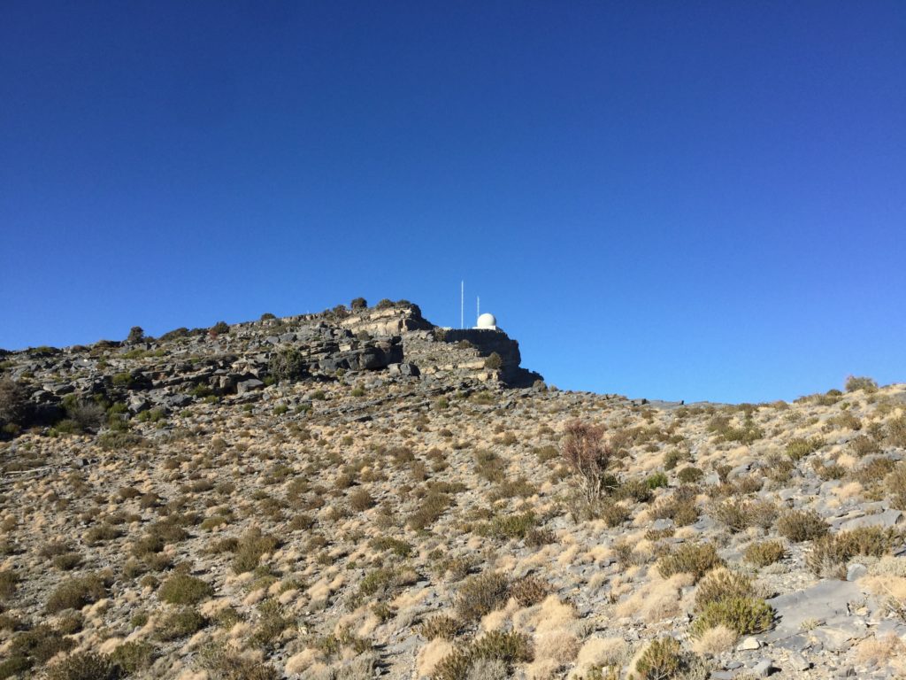
From this point, continue your hike in the opposite direction (right side when facing the military base) and follow the trail signs accordingly.

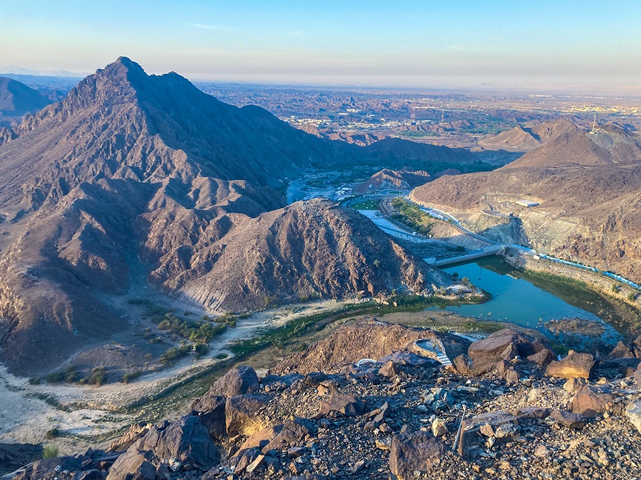
From here, you have a long walk to go (see photo above) for illustration purposes of the distance between the two. You will cross plateaus and wadis or valleys multiple times up to the last ridge. Some ridges have cliffs and you may need to do some scrambling.
3. South Summit of Jebel Shams
After crossing the never-ending valleys, the last valley is where the South Summit is. You will find a circular cairn as a mark of the summit and a tattered Omani flag tied to a pole nearby.
Based on reports of fellow hikers recently, there's also a logbook in the area where you can write your name as evidence that you made it to the South Summit. How cool is that?

And who says there's no view of the canyon? Near the Omani flag is a small corner where you can sit and enjoy a bird's-eye view of the canyon!
Once you're done absorbing the beauty of everything, time to go down, honey. It's a long way down.
Personal Thoughts of the Summit Trail of Jebel Shams:
As I always say, we all have different adventure appetite or what I call ‘#hikeppetite’ to begin with. So, a good trail for me might not be a good trail for you and vice versa. And that’s completely okay, we don’t need to agree with everyone all the time. Anyhow, here’s what I think about the W4 Trail of Jebel Shams:
Pros:
- It is a long trail but not steep nor technical which makes a good trail to test your endurance and stamina. If you're looking for trails like these in the UAE, you may check my Wadi Naqab Loop Trail or Stairway to Heaven’s Full Loop Trail (the original Stairway trail and down to Wadi Litibah).
- You get to see the view of the canyon and reach the summit in one push.
Cons:
- Not the best trail for a day hike. Consider the W6 Trail or the Balcony Walk instead.
- The location of the mountain range is completely remote. If you don't have a vehicle (like me), going to the trailhead is a struggle. There are 'hiking tours' available from tour companies but most of them will take you to the W6 trail only.
- There are no water sources or grocery along the trail nearby or anywhere along the trail (during our visit in 2017). Pack your own and pack enough. Make sure to bring your trash down as well.
- There are no washroom/toilet facilities (to do number 1 or 2) so do it in the wild but make sure to take care of it properly.
Overall, as remote, as it is, Jebel Shams in Oman is one of the best hikes I've done in the region. The long drive from Dubai and the challenge of the trail itself were worth the view we received at the end. Also, despite being a little long, the distance of the whole trail is just right for my appetite. So if Jebel Shams is pretty much the adventure you're looking for, take this as a sign and go for it!
Whatever decision you make, always remember to prepare beforehand, stay safe, and last but not least, enjoy the outdoors! #happyhiking!
With lots of love,
PINAYHAKAWATI 💗
AND AS A GENTLE OUTDOOR ETHICS REMINDER:
LEAVE NO TRACE!