On the border of Uganda and Kenya, within a national park, lies Mount Elgon, a dormant volcano with its highest peak called Wagagai Peak. Hiked through a trail called Bushiyi trail, I spent two and a half days in my first African wilderness, and boy it did not disappoint! Keep on reading!
MUST READ: A Journey of Redemption: Finding my way to the summit of Mount Elgon in Uganda
Hiking Trail Overview:
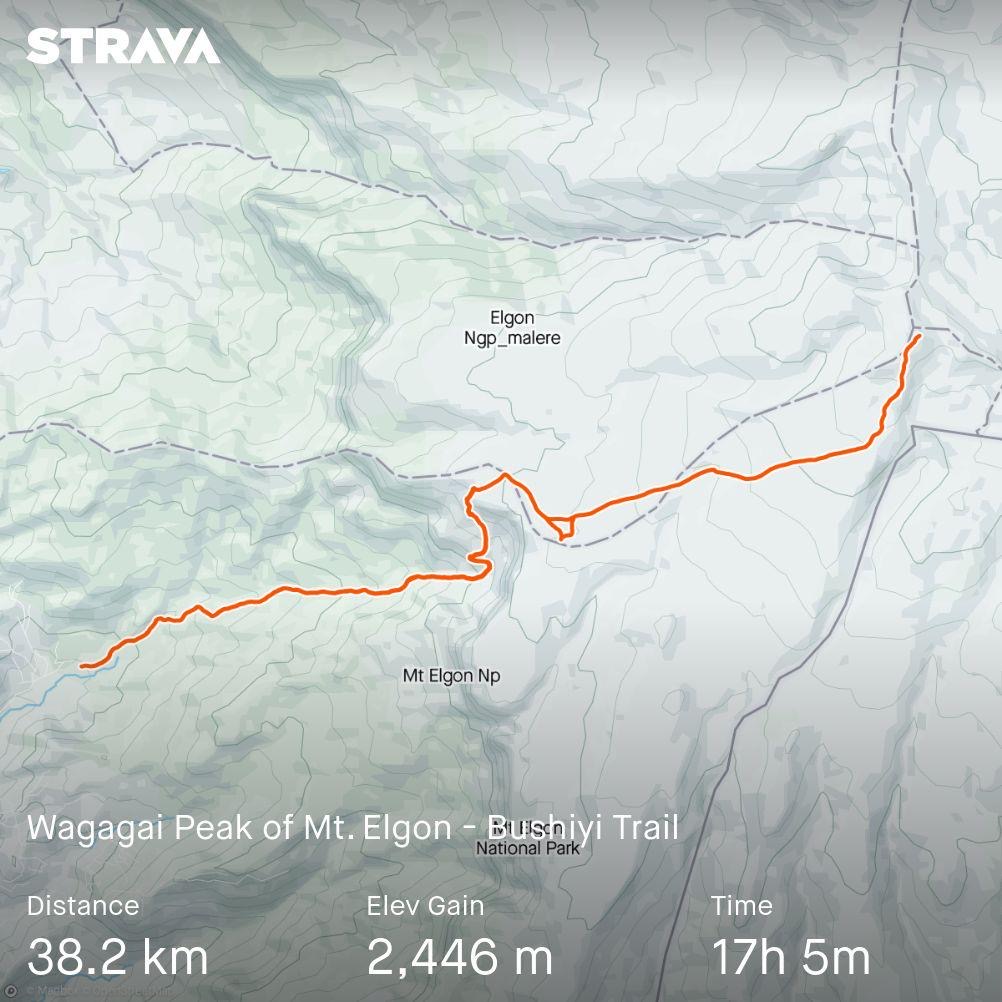
- Route: Mount Elgon Bushiyi Trail to Wagagai Peak in Uganda
- Distance: 38.2 km in total
- Day(s) Needed: 3 Days (I did mine in 2.5 days)
- Max Elevation: 4,168 MASL (as per Garmin), 4321 MASL (as per the sign at the peak)
- Elevation Gain: 2,446 MASL
- Actual Moving Time: 17 hours 05 minutes*
- Difficulty Level (own opinion): 3 out of 5
- Ideal time to hike this trail: The trail is open all year round but the best season is during the dry season which is from June to August & December to February.
*Actual moving time does not include breaks for meals and time spent at the campsite to sleep.
How to get there and how to get out?
Contrary to my initial expectations, getting in and out of the trail is not as complicated as my experience in Central Asia where public transportation involves hitchhiking. In Uganda, the boda bodas (motorcycle taxis) save the day!
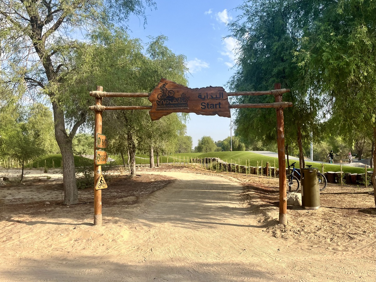
The trail is also a backtrack trail which means you will start and finish at the same trailhead - at the ranger post of Bushiyi in Bududa. Refer to the pin location below:
Public Transportation as an Option
Based on my experience, I had a combination of public transportation and arranged transport courtesy to Ramazan of Mount Elgon Trekkers. The arranged transport part can be substituted with a boda boda option too.
To give you an idea of my journey, it goes like this:
Kampala -> Mbale -> Bududa -> Bushiyi Ranger Post and vice versa
For a more detailed breakdown of the transportation and costs, see below:
| Direction: | Mode of Transportation: | Duration of Journey: | Cost as of April 2024: |
| Kampala To Mbale | Matatu (mini-bus) or Bus | 5 to 6 hours | UGX 30,000 by a Matatu and UGX 30,000 by a Bus |
| Mbale to Bududa (Riverine Resort) | Ramazan's Car (my experience) but can be done via a Matatu | 1 to 1.5 hours | I have no idea as we took Ramazan's car but I will come back to you with updated information |
| Bududa to Bushiyi Ranger Post | Boda Boda (motorcycle taxi) | 40 minutes to 1 hour | I have no idea as Ramazan arranged the boda boda but I will come back to you with updated information |
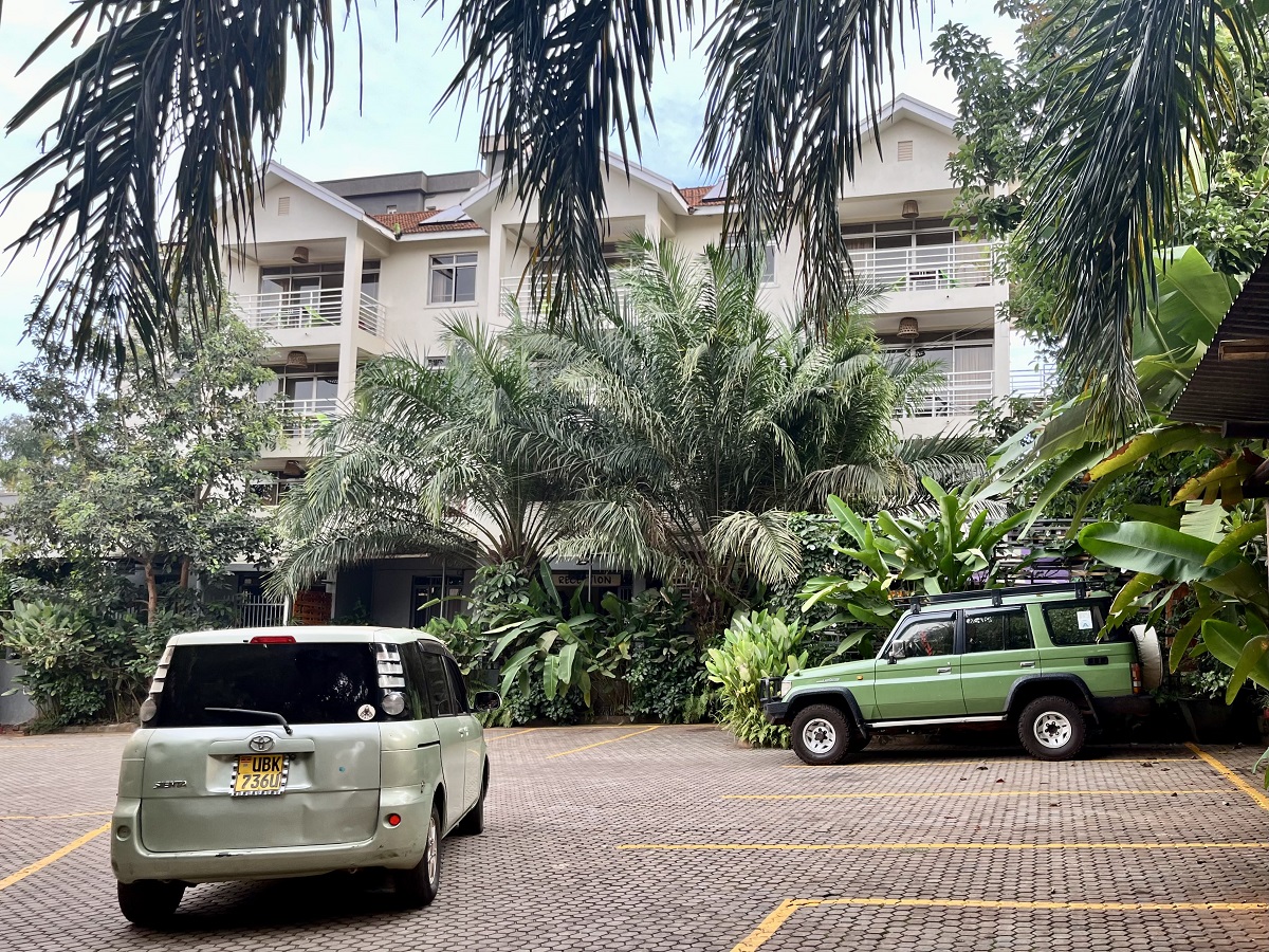
I also stayed at Riverine Resort in Bududa the night before to acclimate (a little bit) and break down the long journey from Kampala. Then we took a boda boda from Riverine Resort to the Ranger Post.
The overnight stay in Riverine Resort and the boda boda is arranged by Ramazan of Mount Elgon Trekkers. However, you can arrange it on your own. Navigating public transportation in Uganda is also straightforward and a fun experience since Ugandans are very helpful people.
Hiking Trailhead (Bushiyi Trail from the Uganda Side):
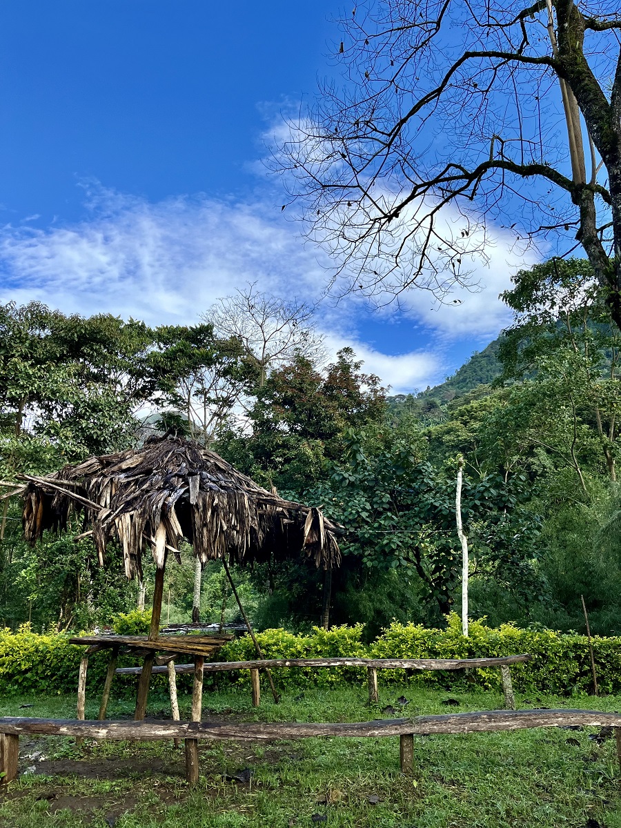
The ranger post in Bushiyi as mentioned above is the official trailhead (or jump-off) of this trail. While we were preparing for the hike, I looked around the vicinity and saw a few shower areas nearby. There were a few huts to sit and rest too.
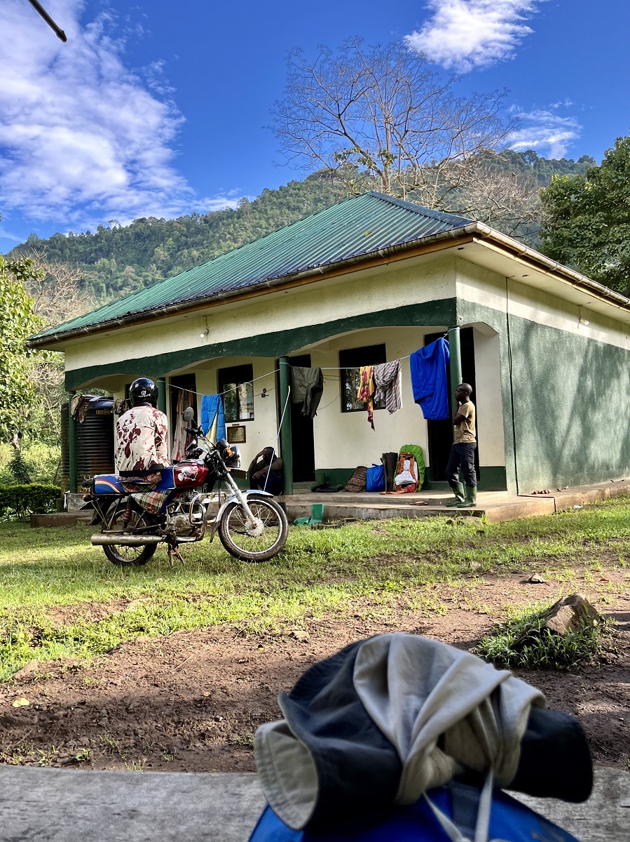
However, there are no stores nearby so make sure to pack all your essentials and snacks or buy them from Mbale or Bududa.
Hiking Trail Sections of Mount Elgon through Bushiyi Trail to Wagagai Peak:
Divided into four climate zones, I will use the same in this guide for clarity. However, instead of four, I combined the last two zones due to my incompetence as I couldn't distinguish the border between the two zones. And I was too shy to disturb the people I know (contacts are shared below too) just for them to explain it to me over the phone. Okay, enough of my excuses and you will understand my point later below.
And as my usual reminder, DO NOT UNDERESTIMATE THE TRAIL. Let's get started.
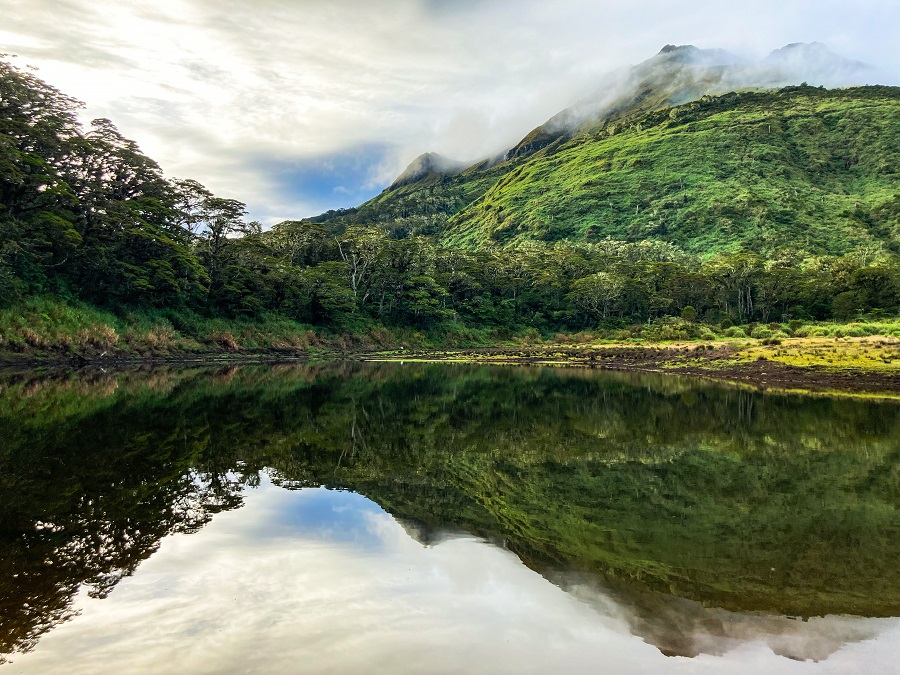
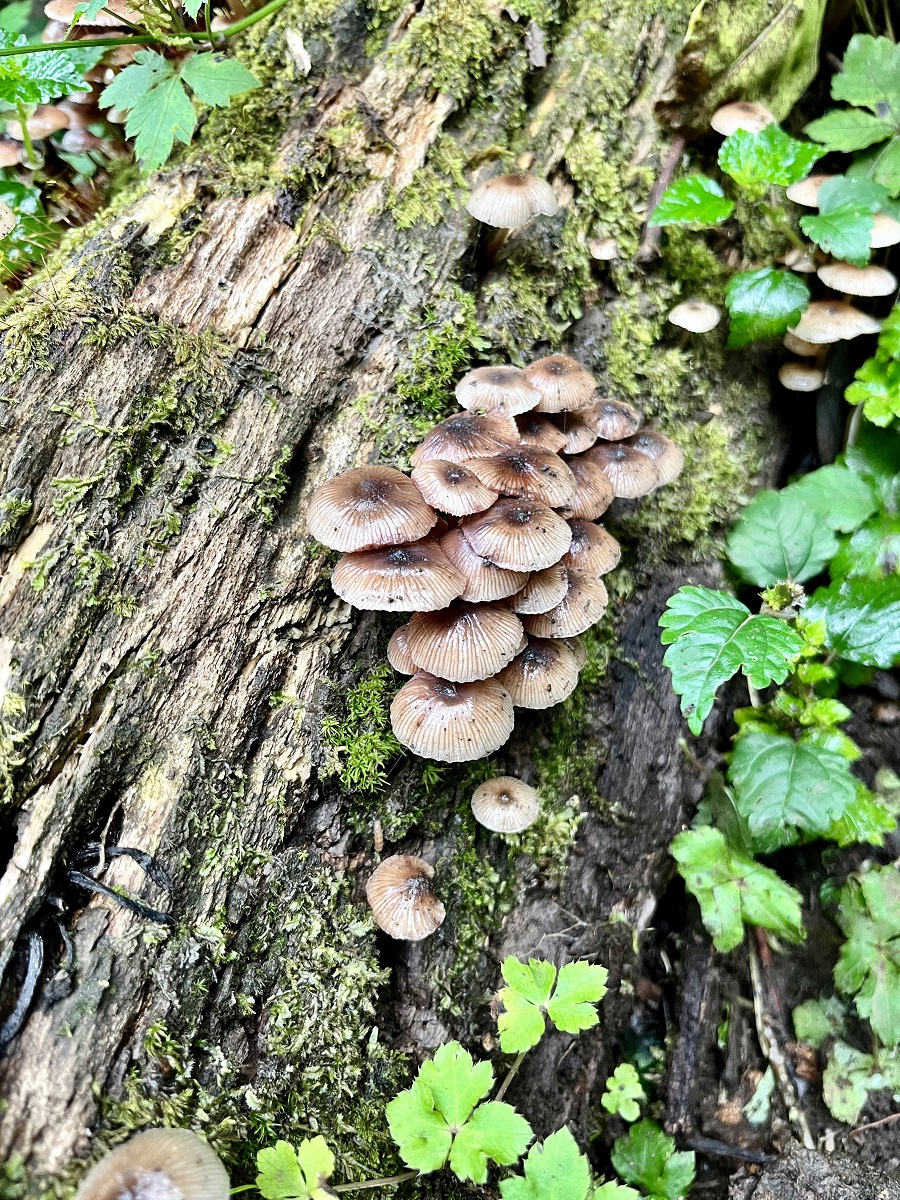
1. Montane Forest
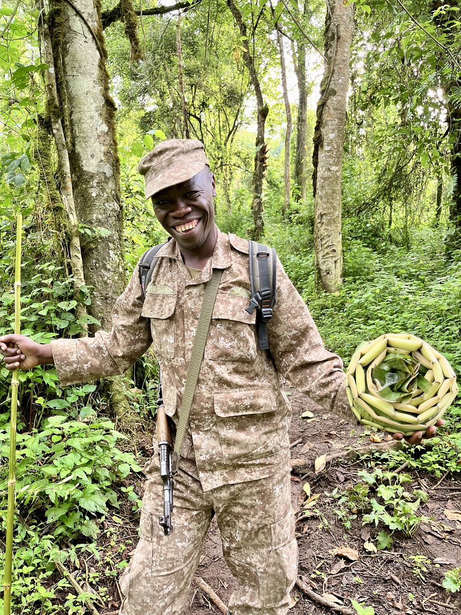
Our hike started slowly as we entered the forest. Mr. Paul, who was the ranger guide leading me, shared some information about the forest. He told me that the first part of the forest is called a Secondary Forest followed by a Primary Forest.
Despite coming from a tropical country, I have not encountered such terms (I'm embarrassed). Fortunately, Mr. Paul kindly explained the difference between the two. He stated that the Secondary Forest was planted and seeded with select tree species. I blanked out when he told me why but I assume it's part of the rehabilitation of the forest. Meanwhile, the Primary Forest was all grown naturally and without any human intervention.
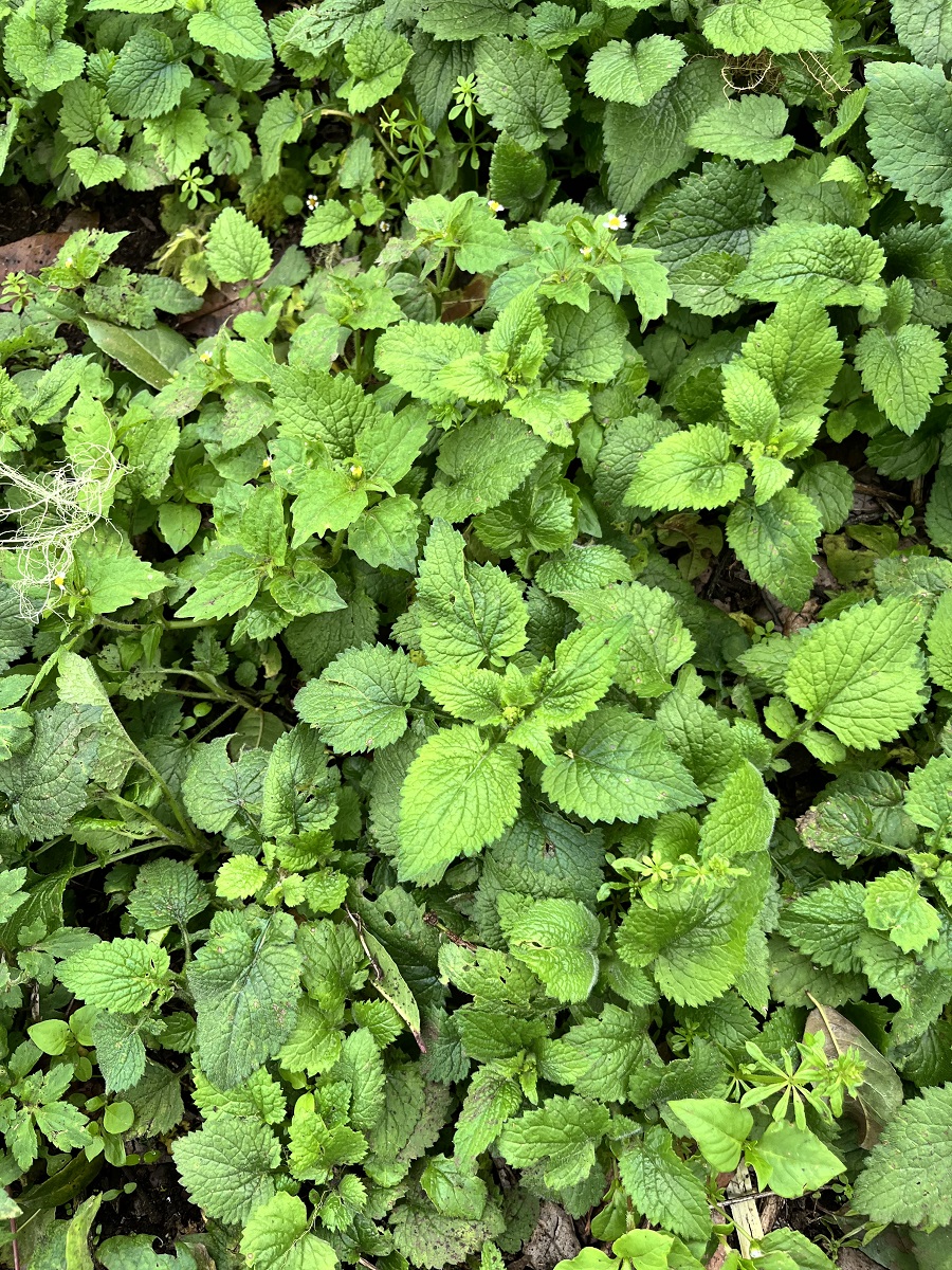
Thanks to these lush forests and its healthy ecosystem, the national park serves as a home and a provider to the locals for so many reasons. With regulations in place, the locals can take (or harvest) whatever they need such as edible plants for consumption, shrubs & stalks for animal feeds, herbs for medicine, and wood from dead trunks of trees.
Unfortunately, I didn't get to see any animals but my eyes were so amused and busy looking at the variety of plants all around me. I guess I would be a botanist in my next life 😉
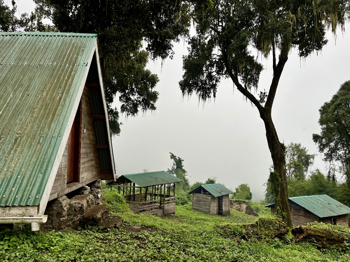
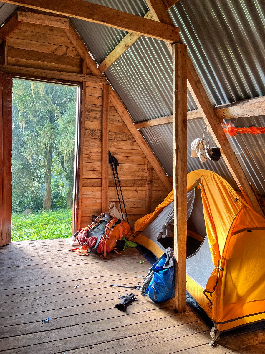
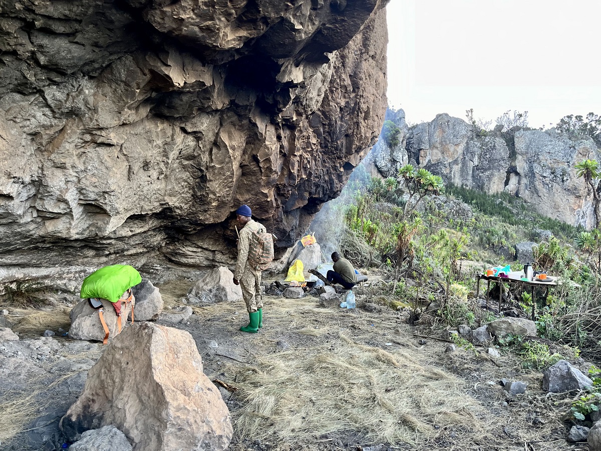
In the middle of the forest was a campground made by the Uganda Wildlife Authority. There is a toilet hut (a squat one), an open rest hut for hikers, a rest hut for the ranger guides and porters, and an A-Frame hut for the night. We took our lunch break here on the first night and as a refuge to sleep on the second night.
2. Mixed Bamboo Zone
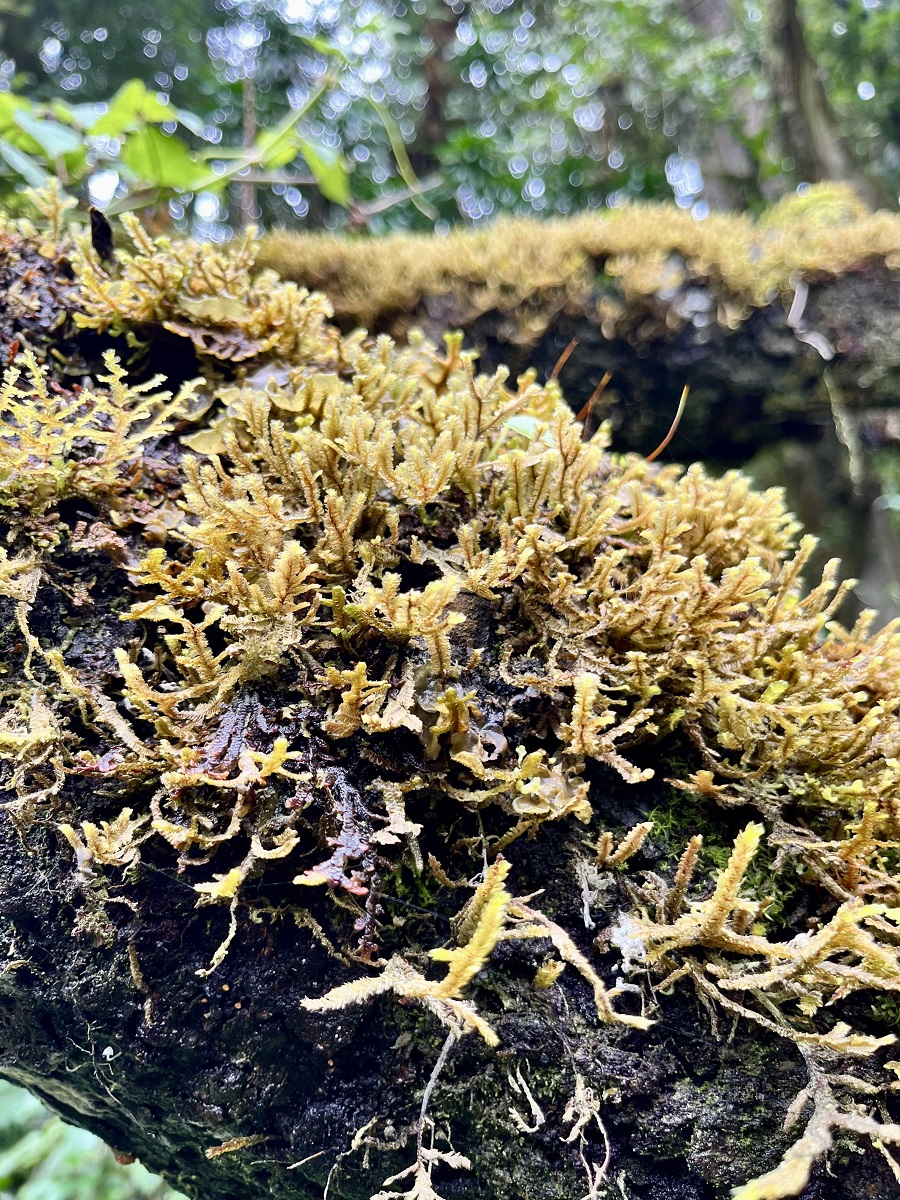
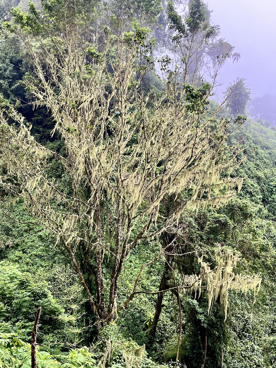
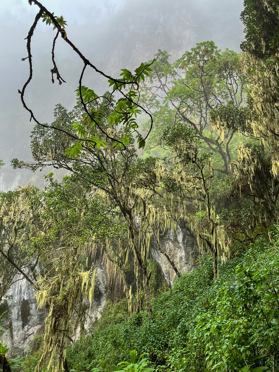
Entering the bamboo zone, the trek continues on the dense forest with a variety of trees covered by beard lichens called Usneas. Most of them are what they call the Hagenia Abyssinica tree commonly known as the African Redwood. It was such a mystical sight, and when the fog hit the view, I felt like I was in a fantasy world or something.
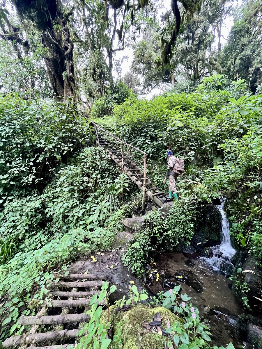
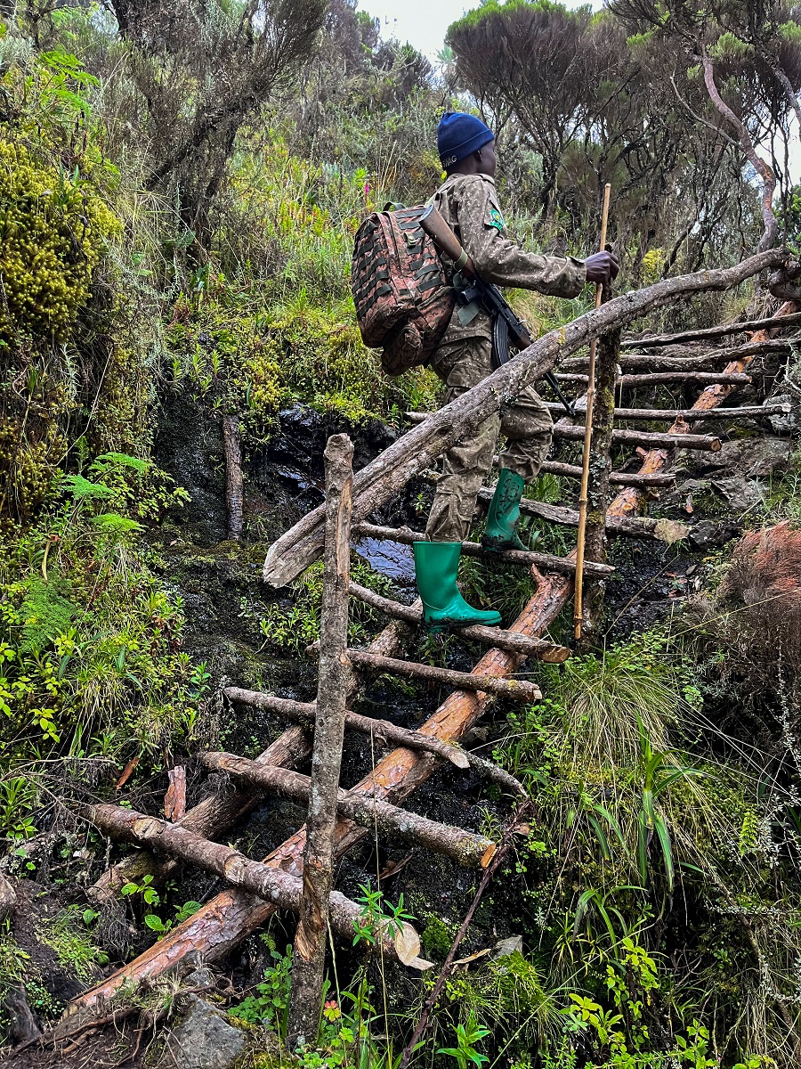
Make no mistake, this section is the most challenging one for me. Some serious steep sections caught me off guard big time. The trail was also wet and slippery because it was during the wet season. We took a lot of wooden stairs as well which were all slippery too, so be careful on your steps.
We also crossed streams by going down a slope and then climbed back again by stairs on the other side. We did it a couple of times until we hit the end of the forest.
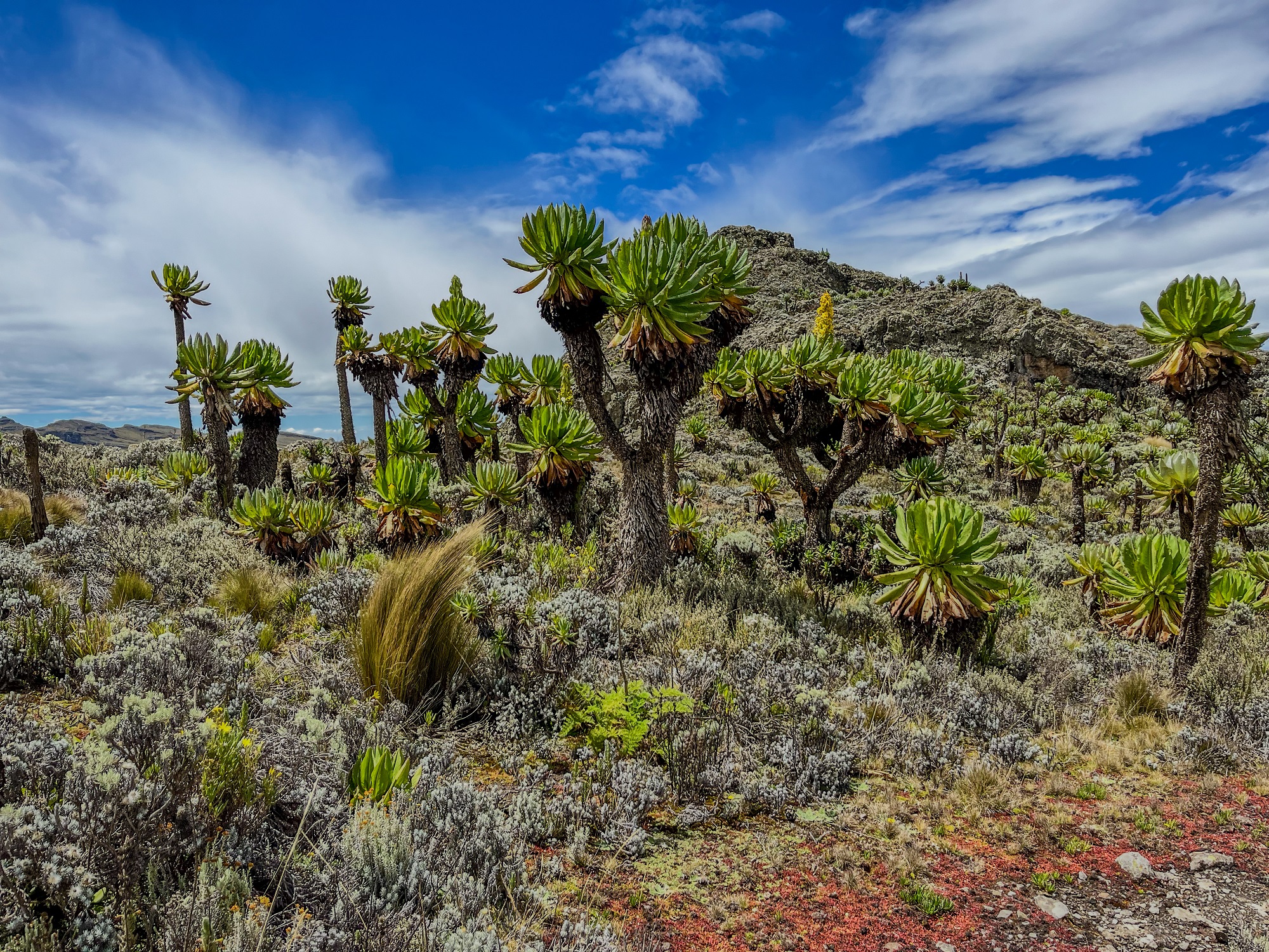
3 & 4. Heath Zone & Moorland (Giant Groundsels and Wagagai Peak)
Now on to my incompetence confused brain, we're down to the last two zones of Mount Elgon National Park. As mentioned, I couldn't tell where it started and ended so I am just combining them. Once I get clearer information on this, I will update it right away.
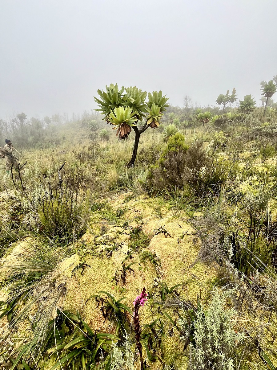
The landscape has changed dramatically and the terrain is finally walkable with a gradual ascent. Due to its elevation, the vegetation found in this zone were all unique and typically found in higher elevation.
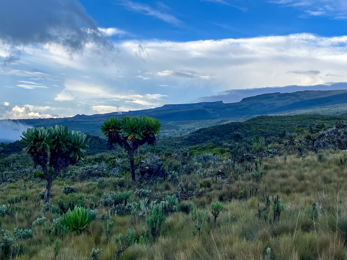
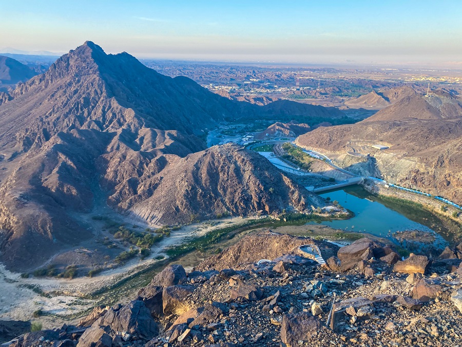
As we walked higher, the famous Jackson Peak or Jackson Table came into our view. It seems to be one example of a mesa or what they call a flat-topped mountain and I was happy to have seen one in person.
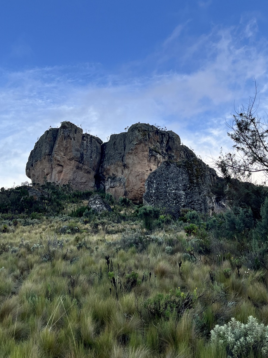
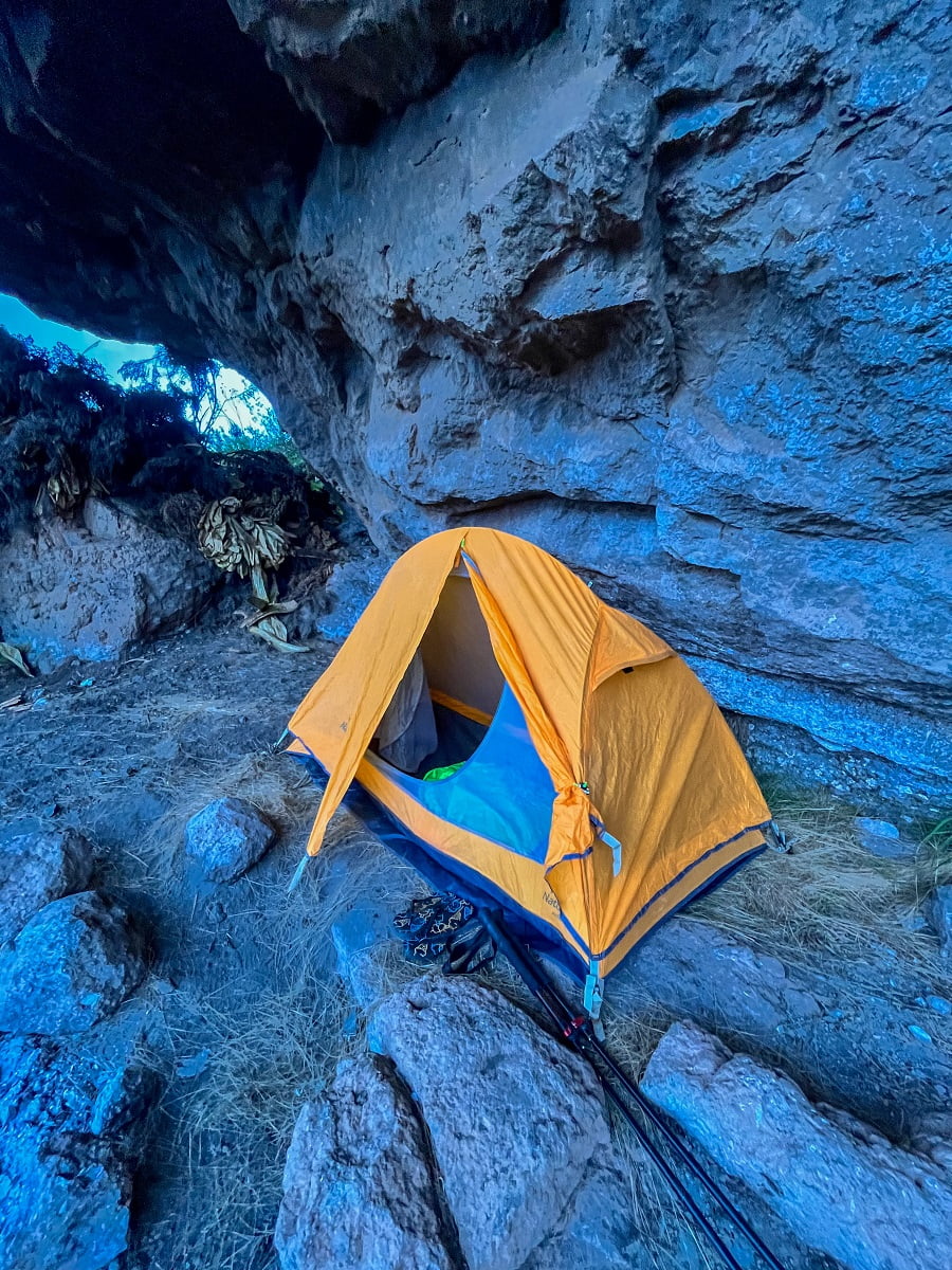
Then comes the rock formation at 3,600 MASL which became our refuge for the night.
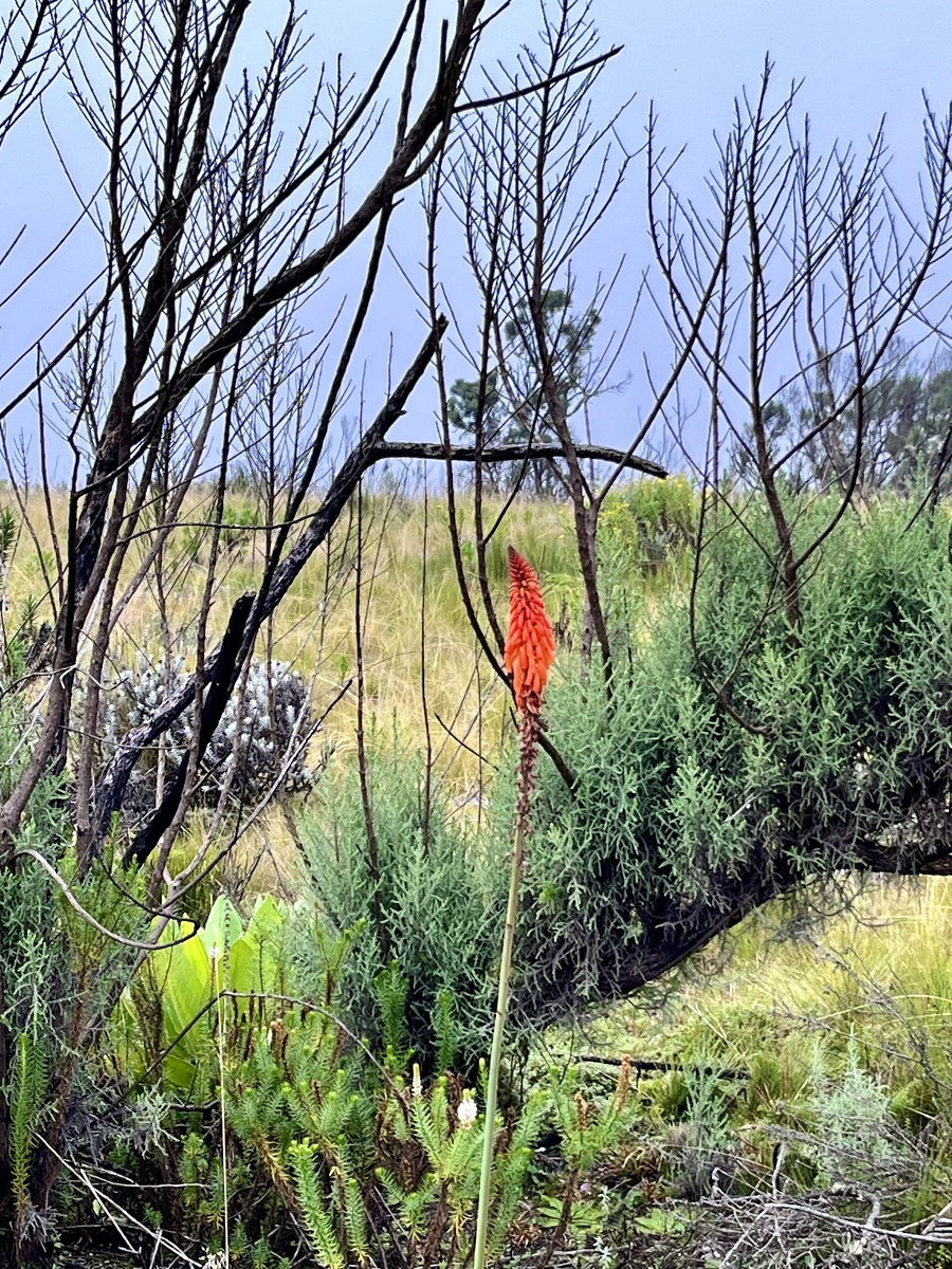
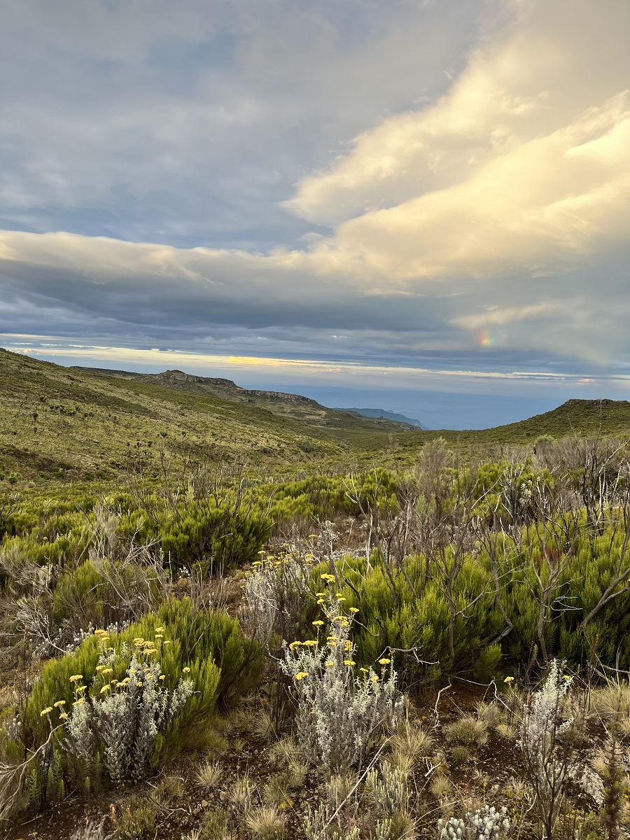
The trail then continued in the moorland, another first to me. It was a long and vast stretch of land with mostly grasses and shrubs.
The Kenyan side of Mount Elgon was also visible with its valley serving as the natural border between the two countries. As shared with me, the team has not crossed the valley into the Kenya side yet, but planning to do so in the future.
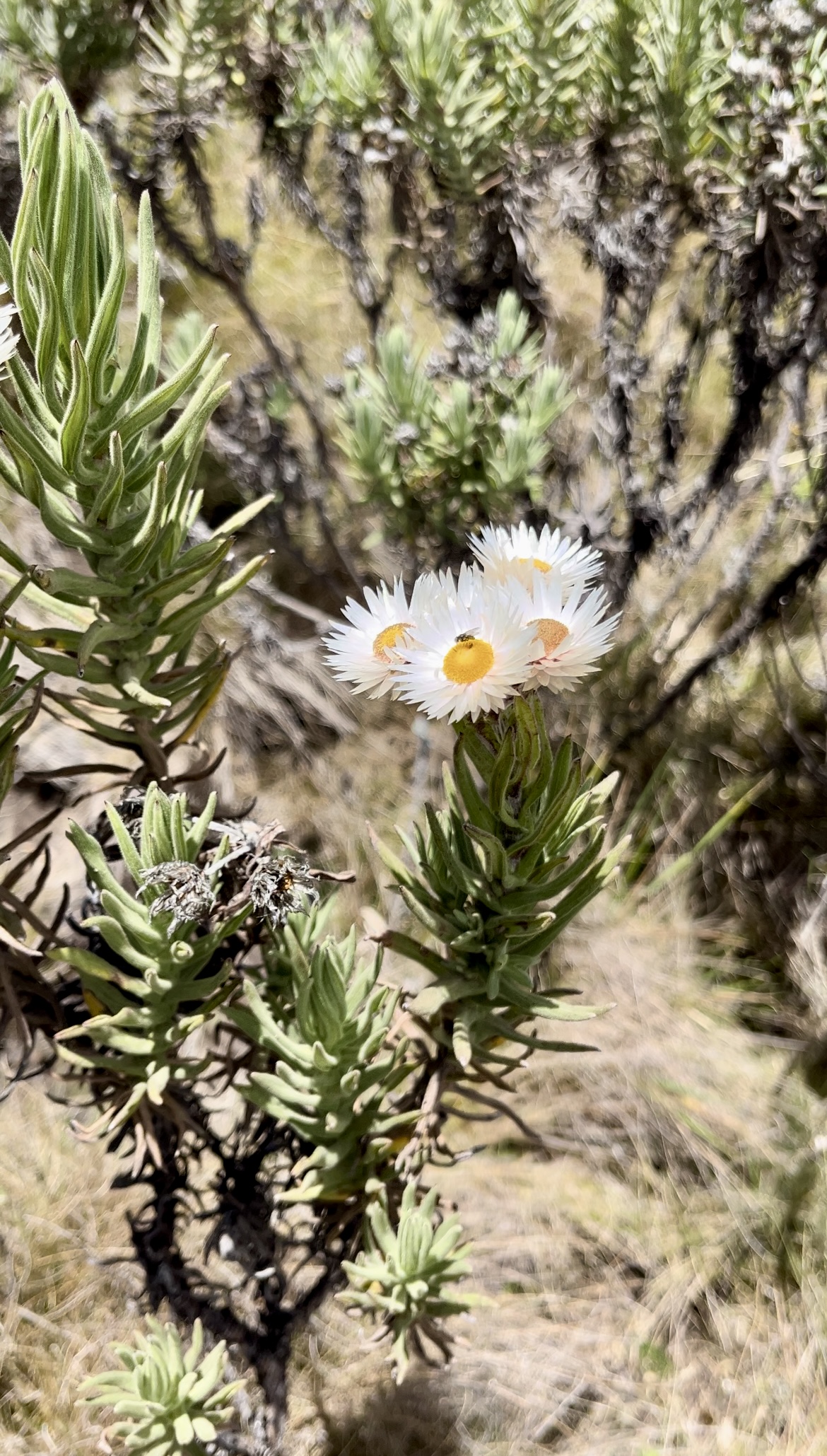
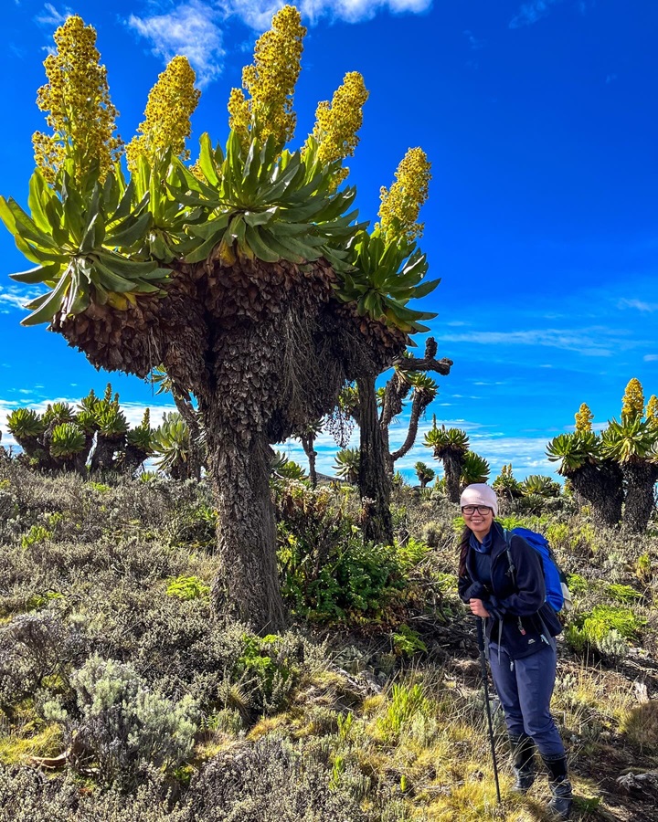
As we came closer to the peak, the giant groundsels and wildflowers appeared one by one in their full glory. What a sight to behold as I struggle for oxygen lol.
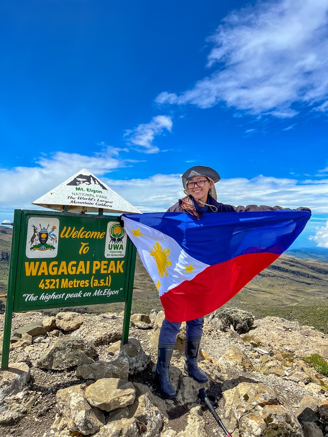
After the long hike starting from the Bushiyi trail, we finally reached Wagagai Peak, the highest peak on Mount Elgon National Park at 4,321 MASL! Time to go down now.
Hiking Arrangements & Contact Person(s):
In a new section I'm adding to my hiking guides, you will find contact person(s) who knows this particular trail. You can inquire from them regarding their guiding service, transportation arrangements, and even other nearby trails. Rates may vary so use your negotiation skills accordingly if needed.
- Mount Elgon Trekkers
- Discover Sipi (I inquired from them but I booked through Mount Elgon Trekkers)
- Mulima Adventures (I inquired from them but I booked through Mount Elgon Trekkers)
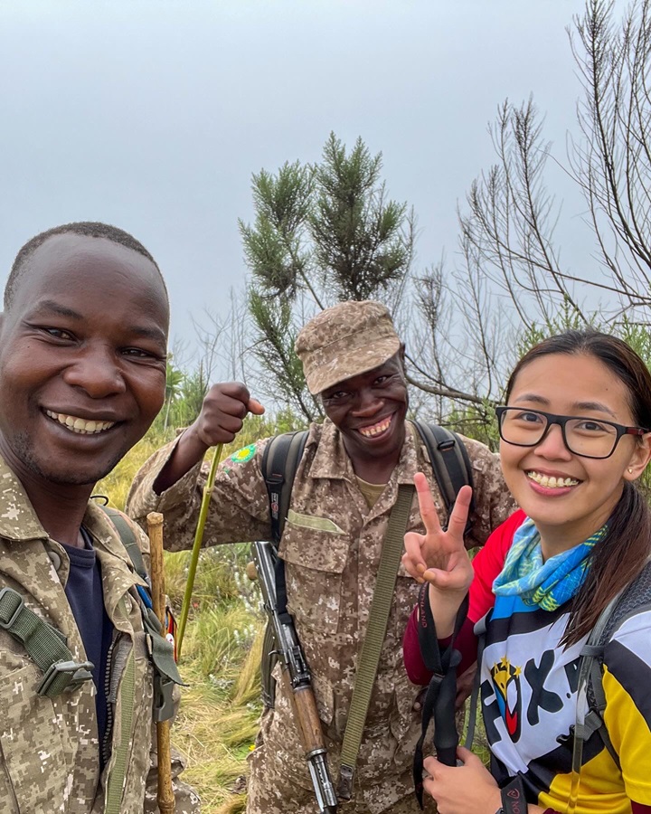
Also, let me share the contact number of the Ranger Guide who went with me. You may ask him questions and inquire from him anything about the trail.
- Paul Ngorok - +256 772 191368 (reachable through Whatsapp)
BONUS: Hiking Certificate!
Not a first time, but this is my most memorable hiking certificate so far. Not only because it's my highest record so far but because I was thanked so genuinely by the ranger guides. Mr. Paul & Mr. Andrew thanked me for my preservation contribution to Mount Elgon's National Park while they were handing me the certificate. I got teary-eyed while receiving it because I felt their sincerity and gratitude.
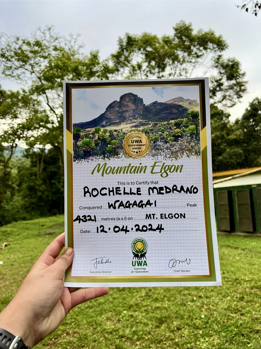
I assumed that my only contribution was the fees I paid towards the National Park, to which I didn't give enough thought before hiking. I didn't realize the overall impact of my visit - the monetary value that may contribute to the preservation of the national park, the source of livelihood of the ranger guides and porters, and the slight boost of tourism that I could even deliver.
Mount Elgon is not as famous as Mount Kilimanjaro and they probably don't receive funds as the latter. So here I am, hoping to give justice to this hiking guide to the best of my ability. And while I am not the best marketer out there, this won't go viral for sure. But I am hoping that my fellow hiking enthusiasts will discover my blog and one day decide to hike any trail from Mount Elgon to Wagagai Peak anytime soon!
Personal Thoughts:
As I always say, we all have different hiking appetites or what I call ‘#hikeppetite’ to begin with. So, a good trail for me might not be a good trail for you and vice versa. And that’s completely okay, we don’t need to agree with everyone all the time. Anyhow, here’s what I think about my hike to the Wagagai Peak of Mount Elgon through Bushiyi Trail.
Pros:
- It was a nice training ground as my first 4000-er peak in a short amount of time. The overall duration of the hike (2.5 days) is also not rushed and not prolonged either.
- Since this is my first (East) African adventure, seeing the giant groundsels with my own eyes was an out-of-this-world experience.
Cons:
- Hiked during the rainy season, there were a lot of muddy and wet sections along the trail. I suggest going on a dry season so that it becomes more comfortable for you.
- Hiking on your own is NOT ALLOWED. For your safety, you will have to hire ranger guides so prepare extra funds for their service fees and tips!
- As a budget traveler, the overall cost spent during this hike was way outside my budget (no regrets though!). If you are on a budget and looking at 4000-er peaks, consider other regions such as Central Asia and/or the Himalayas.
That's all from me and I can now finally sleep in peace after working in this guide for so long. Ciao!
Whatever decision you make, always remember to prepare beforehand, stay safe, and last but not least, enjoy the outdoors! #happyhiking!
With lots of love,
PINAYHAKAWATI 💗
AND AS A GENTLE OUTDOOR ETHICS REMINDER:
LEAVE NO TRACE!